New to Fallout is the addition of Treasure Maps that can be found during your adventures in Fallout 76. It’s possible to find these in containers while exploring Appalachia, though players may have a better chance of locating one in more dangerous “dungeon” type areas.
Upon finding a Treasure Map, you’ll be given only faint clues – a drawing of the area the treasure is located, with no apparent names or writing – and you’ll have to use the landmarks shown, cross references with the icons on the map to figure out its location.
The only real clue comes from the name of the treasure map itself, as it will denote which of the six main regions you can find the treasure in:
- The Forest
- The Savage Divide
- The Ash Heap
- Toxic Valley
- The Mire
- Cranberry Bog
The Forest Treasure Map 7
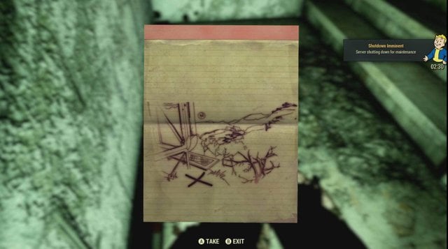
Forest Treasure Map 7 features a view of the Top of the World Ski Resort in the distance, meaning it must be facing off to the Northeast, with the treasure location just below the billboard.
The Forest Treasure Map 8
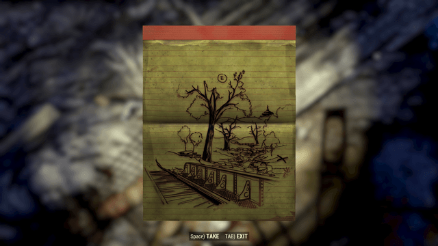
Forest Treasure Map 8 shows the view from a railroad bridge over a large stream, with the Top of the World ski resort just visible off to the East.
These clues point to a region in the North part of The Forest where the railways cross a bridge just past Gauley Mine – in fact, its location is not far from the secondary exit from the Gauley Mine.
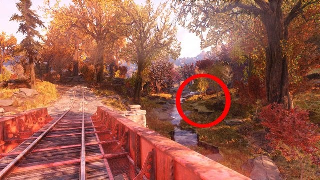
Once you reach the bridge in question and can see the Top of the World dome, jump down and keep on the right side of the stream to look for a grassy mound where the treasure hides.
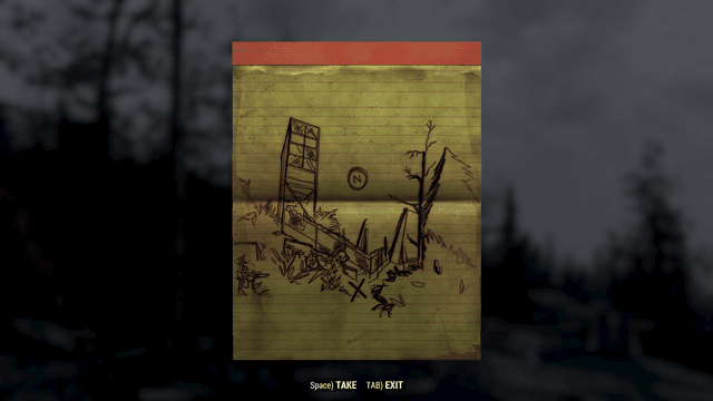
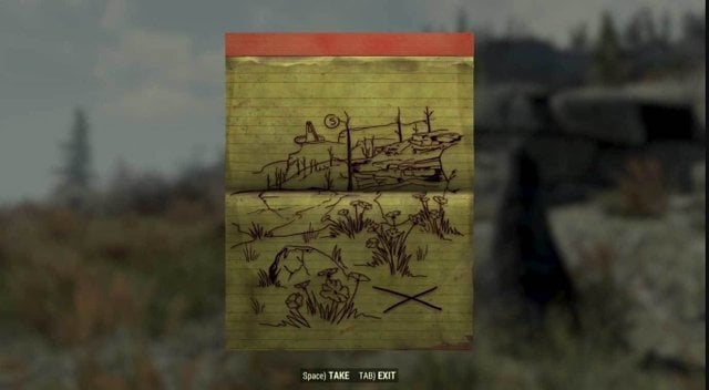
Toxic Valley Treasure Map 4
Toxic Valley Treasure Map 4 depicts a large objects that has crashed in the ground, looking to the north at the location with an X marking the spot on a small ridge overlooking the place on the right side.
This clue marks the spots as the Crashed Space Station, located in the far northeast corner of the Toxic Valley, found in a small valley on the border of the ridges leading up to the Savage Divide.
The treasure itself is located on one of the lower small ridges directly overlooking the site, with a few broken trees in front of it – not to be confused with the higher rocky ridges to the east leading up to an abandoned cabin.
Savage Divide Treasure Map 1
Savage Divide Treasure Map 1 displays a large steel vented tower, with what appears to be spikes behind it, and a chain-link fence with a hazardous waste sign out front – and the treasure itself located below it.
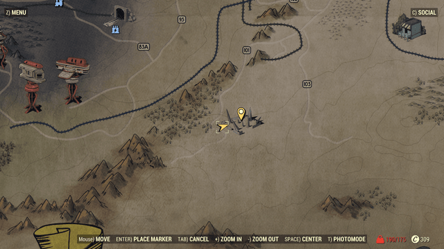
The image referenced is in fact a location in the south of the Savage Divide: The Federal Disposal Field HZ-21, which is a public workshop (and home to a very nasty Snallygaster).
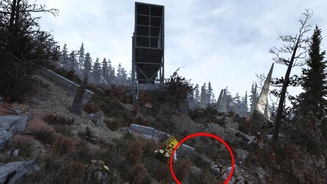
Despite the map’s bearings, the view does not actually point North, but to the East – meaning to find this particular length of fence and the warning sign where the treasure is, you ‘ll want to look at the site from the southwest edge of the disposal field. Once you spot the right nuclear waste sign, look next to it to find your treasure.
Savage Divide Treasure Map 2

Savage Divide Treasure Map 4
Savage Divide Treasure Map 4 depicts a small boardwalk over a pond with a large water tower in the background, flanked by the large ridge in the distance where the remains of the monorail elevator hoops can be seen in the distance.
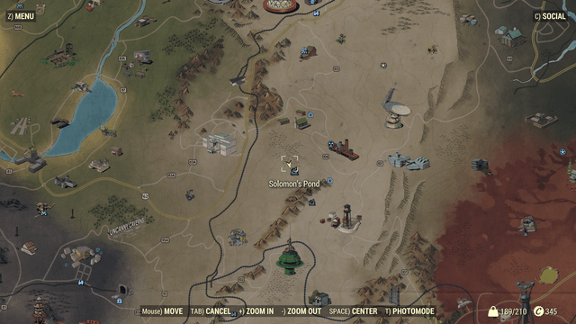
The pond and boardwalk, along with the water tower – point to a location near the south central part of the Savage Divide, Solomon’s Pond, which is not far North of the monorail and the Spruce Knob.

Search the north side of the pond for a small boardwalk, with a bit of water along the north side at at the base of a small hill you’ll find a mound you can inspect to get your treasure.
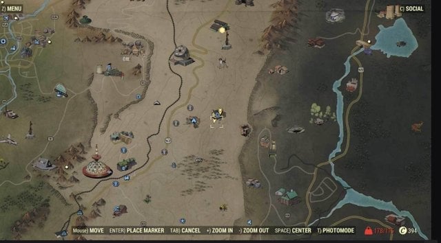
Savage Divide Treasure Map 7
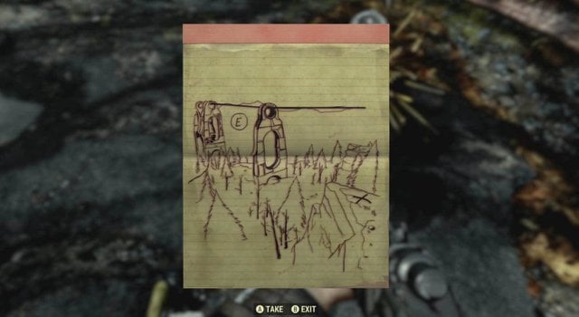
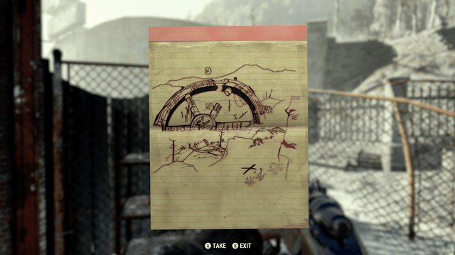
Savage Divide Treasure Map 7 depicts a part of the monorail transit system that runs through the lower half of the Savage Divide, with an X marking a jagged cliff overlooking the part of the monorail line.
The part of the monorail in question actually depicts the Monorail Elevator, which is just past the Spruce Knob terminal and Spruce Knob Campgrounds in the lower Savage Divide.

Head East from the South Mountain Lookout until you come to the edge of the cliffs looking down the Monorail Elevator, and you’ll also be able to see a large blast site to the left. The actual location is a bit tricky, since it’s down on a jagged triangle-shaped platform farther down the cliff – so use Power Armor to drop safely down until you find a platform with a few trees and a mound of dirt where the treasure is
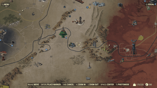
Savage Divide Treasure Map 9
Savage Divide Treasure Map 9 shows a small area with four Carrot Flowers near a rock, with a few bare trees off in the distance to the South where a large satellite dish can be seen on the tip of a ride.
The treasure’s location is pretty deceptive going from the clues on the paper – it’s further north from the National Isolated Radio Array than the image depicts, and is in fact just to the south of the Autumn Acre Cabin in the middle of the Savage Divide.
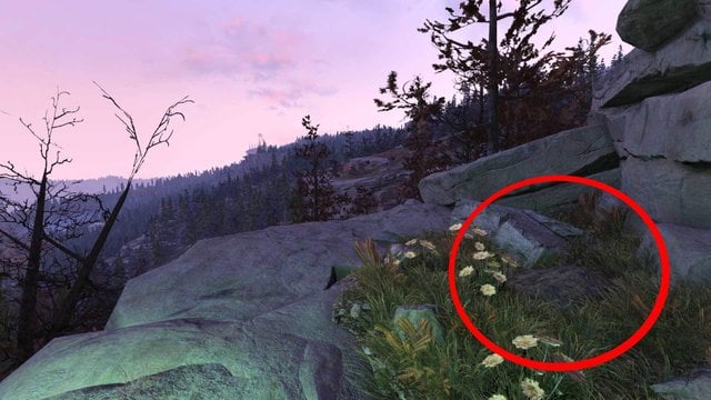
From the cabin, head south along the ridge and keep looking down at the rocks below until you spy a small outcropping of a platform halfway down the cliff. This platforms features the carrot flowers and a rock, and against the cliff on the right (which can’t be seen in the drawing) is where the mound with the treasure lies.